
Our travels between Missouri and Alabama took us through Arkansas, Louisiana and Mississippi. In those parts the area is called “ArkLaMiss”.

From Monett, we cruised south on Highway 71 into Arkansas. With a 287-mile travel day, we didn’t have time to stop in Bentonville and pay homage to Sam Walton. (You can do that at the original Walton’s store downtown, which is now the Walmart Visitor Center.) As big fans of Walmart, will be sure to do that next time.

The tree-covered Boston Mountains between Fayetteville and Fort Smith were just starting to change color as we passed by. In about a week this should be a beautiful drive.

As we headed east from Fort Smith, the cloud cover returned. Our travel day turned out to be a brief break in the rain. We arrived at very soggy Maumelle Park in Little Rock and checked in to our gorgeous riverfront site.

This was the view from our door. This COE park sits at the confluence of the Maumelle and Arkansas rivers. This peaceful spot is just 20 minutes or so from downtown. We highly recommend it!

The forecast for Sunday afternoon was cloudy but dry, so we headed out to visit the Clinton Presidential Library. I wasn’t sure if Paul really wanted to go, but he willingly proceeded.

The striking 150,000 square foot museum sits in a beautiful park downtown. The building is cantilevered over the southern shore of the Arkansas River. After our visit to Monett, we couldn’t help but notice that the building also features “curtain wall” construction. (See, cousins, we were paying attention!)

Just inside the entrance is one of President Clinton’s limousines. That’s one impressive vehicle! It’s part of an exhibit on the work of the United States Secret Service.

The permanent exhibits at the museum include this full-scale replica of the White House Cabinet Room.

The “Life in the White House” exhibits include this table set for a Clinton state dinner. How sparkly!

The museum includes a timeline of the Clinton years in the White House. Along the base of the exhibit are these binders that hold the President’s daily schedule. Flipping through these pages provides interesting insight to presidential life.

This full scale replica of the Clinton Oval Office is impressive. It was also quite cluttered. There’s a lot of stuff in this room!

Paul’s waiting to see the President. Actually, he looks like he is about ready to call it a day.

“Jewels to Jelly Beans” is a new temporary exhibit that showcases treasures from several presidents. This display of First Lady couture is an interesting study in fashion since the Hoover years. This traveling exhibit features all 13 presidential libraries, and will make stops at each. The display will be in Little Rock until January 2010.

Here’s a look at Downtown Little Rock through the curtain wall at the museum. Even though the rain held off for the day, the sky was quite cloudy.


This view from the north end of the museum reveals the very full and muddy Arkansas River. There are plans to convert this old railroad bridge into a pedestrian bridge to North Little Rock. Notice the RVs in the bottom of this picture? That’s the North Little Rock RV Park. It’s nothing more than a gravel lot near the river. And, we almost stayed there! We’re so glad we opted for beautiful Maumelle Park.

We spotted this on a car in the museum parking lot. I think the people of Little Rock miss “their” president.

One of the things we’ve noticed about Arkansas is they grow mighty big churches here. These places are huge! And, there are lots of them. This is the First Pentecostal Church in Little Rock. The building on the right is the “chapel”.

Finding a quilt store in Little Rock proved to be a bit of a challenge. One prominent store recently went “virtual” and closed its store. (We discovered this after arriving at the shuttered location.) An alternative was closed Sunday and Monday. After accepting the fact that I might miss a state, we happened by a tiny store on the way to the Post Office. With less than 50 fat quarters to choose from, I found these four to represent Arkansas.

Just as it had in Monett, heavy rain delayed our departure from Little Rock. With more than two inches of rain in the city - and larger amounts in the southern half of the state - it was not a good day to drive to Mississippi. So, we just hung out and watched the river rise. (We were never in danger, though!)

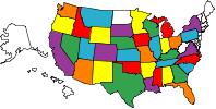
With the rain behind us, we left Little Rock on Tuesday. Our drive through Arkansas was smooth and uneventful. (Just the way we like it.) Our route included a 60-mile pass through the northeast corner of Louisiana. Shortly after we passed this sign, the road got narrow and bumpy. And, so it was for the next 90 minutes or so. Since we didn’t camp, or even stop, in the Pelican State, we weren’t sure we’d add it to our “States Visited” map (see right). But after that grueling trek, we think we’ve earned it!

The destination of our 260-mile travel day was Grand Gulf Military Park near Port Gibson, MS. Shortly after we perched ourselves in this interesting pull-in site at the top of a hill, guess what happened? Yep. It started to rain!

This 450-acre park, perched on the bluffs above the Mississippi River, preserves the memory of a long gone town and the Civil War battle that was fought here. Grand Gulf was settled in the early 1700s. In the next century it became a major port city for cotton shipping. By the mid 1800s, the town population had grown to nearly 1000. But, an outbreak of yellow fever, a tornado and massive flood reduced the devastated community to 158 people. The Civil War destroyed what little was left and the town quietly passed away.
Our three nights here were so rainy we got few pictures. But, the website shows it well. It’s a very historic state park a short stroll from the river. Full hookups are a rarity in state parks, but Grand Gulf has it all. We recommend it.
On the second day of our stay, we ventured to Vicksburg to visit the battlefield there. Shortly after our arrival to town we spotted severe storms brewing to the west, so we headed home to batten down the hatches. When a tornado warning was sounded in the parish across the river, we started paying attention. The town directly across the river, which is just one-half mile away, was in the twister’s path. And, it was heading our way. We quickly closed up our fiberglass box at the top of the hill, loaded up the cats and headed to the park museum to wait out the storm. We used the time to study the Civil War artifacts, talk with the museum staff and plan a great day trip for the next day. Lightning flashed, thunder crashed and rain poured. Thankfully, the worst of the storm passed to our south. Here’s hoping that’s the closest call we ever have with a tornado!

Our day trip to and around Port Gibson was interesting. Most importantly, it didn’t rain! Port Gibson is located midway between Vicksburg and Natchez. Its claim to fame is that it was spared by General Grant when he declared it “too beautiful to burn.”

Port Gibson also claims fame as the city of churches. This town of less than 2000 boasts at least nine churches. (These churches are considerably smaller than those in Arkansas!) The First Presbyterian Church features this unique “Hand Pointing to Heaven” atop its steeple.

About 10 miles outside of Port Gibson, in the middle of nowhere, are the Ruins of Windsor. This National Register of Historic Places property is something to see. In the mid 1800s farmer and landowner Smith Coffee Daniell, II, married his cousin, had three children and built a three-story ante-bellum mansion at a cost of $175,000. Shortly after completing his masterpiece, Mr. Daniel died at the age of 34. Almost 30 years later, a house guest dropped a cigarette and the place burned to the ground. What remained were the stately columns and ironwork. This is how the remains of the formerly glorious and historic place look today. Eerie.

Hey, look! There’s a cache here. Placed in December 2001, this is an oldie in the world of geocaching.

One of the staircases from the Windsor mansion now stands at the front of Oakland Chapel on the nearby Alcorn State University campus.


Looks like the recent rains have provided just the right environment for this thing to take off. We’ve never seen a mushroom like this before.

A couple of miles south of Alcorn State sits the town of Lorman and it’s main attraction: The Old Country Store. It sure doesn’t look like much, but inside we found a tasty lunch buffet of black-eyed peas, collard greens, potato salad, corn on the cob and fried chicken that is billed as the world’s best. For dessert, we had the best peach cobbler (with ice cream, of course) I’ve ever tasted. And, we washed it all down with a big cold glass of sweet tea. Yes, we are in definitely in the south!

The proprietor of the place is known as “Mr. D”, a gracious and warm southern gentleman who makes some fine fried chicken. He makes a point to visit every table and make every guest feel at home. He sings a song about his grandmother, whom he praises as a cornbread cookin’ queen. It was a tasty stop with a healthy dose of fine southern hospitality.

After lunch we headed back toward Grand Gulf making part of the trip on the Natchez Trace Parkway. The 444-mile two-lane parkway commemorates an ancient trail from Natchez to Nashville. Today it is managed by the US National Park Service. No commercial vehicles are allowed, and there are no food, gas or lodging services along the way. This unique combination makes it a very pleasant way to travel this part of the country. With a 50 mph speed limit it’s not the fastest way to go, but it’s definitely the most scenic. One of the things we enjoyed the most during our brief travel on the Trace was seeing the sun come out!

On our last day in Mississippi we made a quick run to Vicksburg to find quilt fabrics. I resisted the temptation to find more than fabrics that depicted rain and rising river waters.
With our fun here in ArkLaMiss done, we rested up for a big travel day into Alabama.


No comments:
Post a Comment