Monday, March 21, 2011

Terlingua

After sleeping in just a bit this morning (Those sunrise drives are starting to catch up with us.) we weren’t sure what we would do on yet another hot, dry and dusty day. We took one look outside at our RV Park and were inspired. We said each other, “Is this place a ghost town, or what?”

We ventured about 15 minutes east to explore Terlingua. This tiny town serves as a gateway to Big Bend National Park and is home to a small community of folks who appreciate its remoteness and rugged beauty. As if things down here aren’t hot enough, Terlingua is also home to Chili Appreciation Society International’s annual chili championship, which attracts some 10,000 “chiliheads” to town each November. And, one more thing. Terlingua’s historic “downtown” is now a ghost town.

On our way to Terlingua we made a quick stop at the Long Draw. This pizza place isn’t open in the middle of the day. We were here to pick up a geocache. There’s Paul making the find. Yep, it was under the flower pot.

As we approached the Terlingua's historic downtown we noticed a sign for this RV Park. By the looks of things, our guess is it’s been a long time since anybody parked at Jo Mama’s. But, we got a chuckle out of its name.

Terlingua’s heyday started with the discovery of cinnabar, the ore of mercury, around the dawn of the 20th century. By 1900, four quicksilver mining companies were operating in town and its population grew to 2,000. World War I brought increased demand for mercury, which was used to make explosives. The wartime boom was followed by a bust. The Chisos Mine struggled to make it through World War II. In 1946, the mine and the town were abandoned. For more than half a century, the remains of this mining town have crumbled.

This looks like a movie set, but it feels like a real-life ghost town. With no fences around, visitors are free to roam around the ruins. Signs are posted outside the structures that are private residences. The structure in the foreground was once the Perry School. The private residence behind it is known as The Mansion. That’s right, somebody lives there!

This ghost town has evolved into an eclectic community of characters who apparently don’t mind living in ruins. Many of the local residents are artists, and sculptures dot the landscape.

Yesteryear’s filling station is today’s picnic shelter.

Relics of Terlingua’s mining past can be seen all around town.

The old Terlingua church is one of the few structures around that is undergoing restoration.

The door was open. So, of course we went inside.

The church is still used for services...and yoga lessons.

Every ghost town has a cemetery. This is Terlingua’s.

The final resting place of the townspeople is as unique as the town. This still active cemetery is a powerful reminder that life, and the afterlife, can be rough and rugged in the Big Bend region.

The Starlight Theater is a Terlingua icon. This restaurant and bar features entertainment and dancing nightly.

The Leapin’ Lizard Gallery is one of a handful of businesses around town.

This pirate ship compound looks like a business, but it’s not. It’s the place one Terlingua resident calls home. You have to agree, that's one catchy name.

After rambling around these ruins, we were hungry! We stopped by the El Dorado Hotel and checked out the High Sierra Bar and Grill.


Inside we enjoyed friendly, laid back service and got a taste of Terlingua today. The burger and fries were delicious. And, one beer easily turned into two. That’s just the way it is here!

After all, when you’re hanging in a ghost town, what’s the hurry?

Sunday, March 20, 2011

Big Bend: Balanced Rock and Chisos Basin

We were up so early this morning we saw the "Supermoon" again. The things we will do to beat the heat! This is actually a picture we snapped last night just after the full moon rose. As we were leaving the campground this morning we saw it again just before it set. That was early!

We were well into Big Bend National Park before the sun rose over the Chisos Mountains. We traveled along the smooth and familiar road until it was time to make our turn.

About eight miles into the park, we turned left on Grapevine Hills Road. According to the park map, this is an "improved dirt road". Where we come from, this was one rough washboard. We were on this bumpy track for about seven miles. Rocky was having a great time! We just hung on and enjoyed the view.

When we arrived at the Grapevine Hills trailhead, the early morning sun was casting long shadows on the trail. Though this easy trail is less than two miles, we were happy to be here long before the heat of the day.

We spent much of the time walking in a sandy river bed on this flat trail flanked by gorgeous red rock mountains. We were so close to them it was tough to get a decent photo. As we approached the end of the trail, we looked back and were treated to this view.

Though we had reached the end of the "easy" trail, our destination was still a quarter mile away. Here is a marker for the rest of the trail, if you can call it that, to Balanced Rock. Although the remaining distance wasn't far, it was definitely a climb.

The climb was well worth the effort. With help from a friendly trio of hikers, we captured our moment at Balanced Rock. This giant "window" of boulders is one of the most picturesque spots in all of Big Bend National Park.

We managed to climb down safely and made our way back to the trailhead and back to the main road by late morning. Temperatures were still reasonable, so we decided to make the drive to nearby Chisos Basin. Thankfully, this road was paved. The views along the way were magnificent!

As we approached Chisos Basin, we spotted the Chisos Basin Campground (lower right). There are no hookups in this park, and Bullwinkle is way too big to take the road to get here, but it would be great spot for small trailer or tent camping. We took a quick tour of the campground to locate the Window trailhead, which we might hike on our next early morning visit.


The Chisos Basin Visitor's Center offers stunning views of the Chisos Mountains and another trademark Big Bend spot: The Window. This picture doesn't do it justice, but it's the "V" in the center of the mountain range. On a clear day you can see forever through the window. Today, unfortunately, it was pretty darn hazy. We took advantage of the view and enjoyed a picnic lunch at this lovely overlook.

It was starting to get warm at Chisos Basin, but by the time we were back at Maverick Ranch in Lajitas it was hot. The hazy sky kept the temperature in the low 90s, and Bullwinkle's trusty air conditioner kept us cool as we enjoyed a well-deserved afternoon nap and more NCAA tournament basketball. Rock chalk!

Friday, March 18, 2011

Big Bend: Rio Grande Village

With daytime temperatures well into the 90s, our strategy for visiting Big Bend National Park this week is to get up with the sun and be home by early afternoon. When we left the RV park about 7:30 this morning, the temperature was a comfortable but still slightly dark 59 degrees.

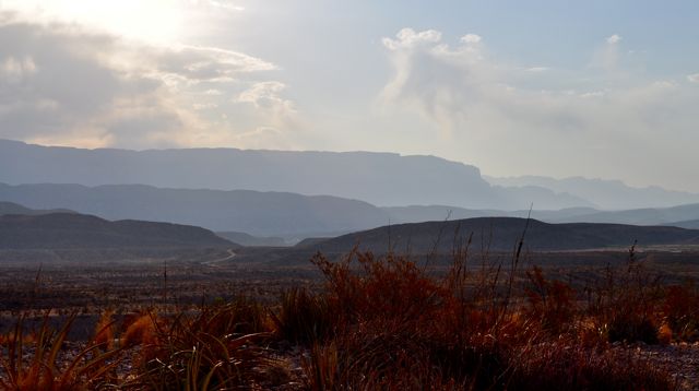
Today's mission was to explore Rio Grande Village, on the eastern side of Big Bend. With 120 miles or so on our itinerary, we were happy (and smart) to make this a sunrise tour. A few miles before reaching Big Bend we stopped to capture this magnificent start to the day.

Could you receive a more picturesque welcome to a National Park? We purchased our new Annual Park Pass and headed into the rising sun.

At the first turnout we just had to get one more shot of sunrise over the Chisos Mountains.

The morning light kept changing the spectacular mountain views, which kept the passenger of our pair very busy. We look forward to coming back to explore the Chisos another morning this week. (It's supposed to be a little cooler up there!)

As we approached the southeastern edge of the park, we stopped at the Rio Grande Overlook. Good Morning, Mexico!

In Rio Grande Village, we found our way through the campground to the trailhead of the Rio Grande Village Nature Trail. After passing through some dense vegetation, the trail opened up to a raised boardwalk across a restored wetlands area. This is a favorite area for birders, but we recommend it for photobugs, too!

We made our way up the trail to a promontory with panaromic views of the Rio Grande River.

And, what's the view across the river?

The Mexican village of Boquillas. Click on the picture and you can see some of the buildings in this very small town of less than 200 residents. Downriver from Boquillas is Boquillas Canyon, our next destination.

When we stopped at the Boquillas Canyon overlook, a man was tending to this small display of trinkets from Boquillas. This is one of many displays we saw as we hiked along the river. Signs are posted at trailheads warning that visitors possessing these items are subject to a fine.

After the man took care of his display, he paddled back across the border. We spotted a couple of Border Patrol planes during our outing. With no legal border crossings in the park, anyone crossing into Mexico can be prosecuted, with up to $5,000 in fines and/or one year in prison. Needless to say, we were happy to stay on American soil.

Our last hike of the day was the Boquillas Canyon Trail. Temperatures were definitely on the rise when we started this short but very scenic trail. We just had to get one more shot of the Rio Grande!

We hiked into the canyon to enjoy the views, a picnic lunch and some very welcome shade!

This cool spot on the border was the perfect spot to enjoy our lunch. Rested and refreshed, we headed back to the Jeep. With Rocky's air conditioner humming, we retraced our route across the park. By the time we returned to Lajitas, the thermometer was at 93 degrees. Good timing!

We spent the rest of the afternoon cooling off and watching the NCAA basketball tournament. The KU-Boston U game just got underway. So, it's time to close. Rock chalk!

Thursday, March 17, 2011

Lajitas

Here's another look at our resident "weather cat". No, we're not in Brrville anymore. Yesterday we arrived in Lajitas, where it is hot, hot, hot! Can't you tell? That's one warm kitty!

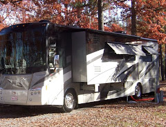
We've booked a week at the Maverick Ranch RV Park here in Lajitas, where the daytime highs are forecasted to soar well into the 90s each day of our stay. This is a look at our first site here just before we moved to our second. All it took was one afternoon of west Texas sun blazing in that mega windshield for us to find a new site where we could turn the moose around. Now we're pointed toward the north, with a nice view of the towering red rock peak. (And in this practically treeless place Bullwinkle can make his own shade for the patio.)

Lajitas sits on the US-Mexico border between Big Bend National Park, to the east, and Big Bend Ranch State Park to the west. We took a short drive into the state park to catch a peak at the Rio Grande River. Mexico is on the left and the USA is on the right.

The history of Lajitas is colorful, indeed. This one-time cavalry post didn't get electricity until 1949. Eventually the population dwindled to four. In 1977, a Houston entrepreneur bought the town and began restoration efforts. By the early '80s Lajitas had a 9-hole golf course, a couple of hotels and a few condos. That effort never really got off the ground and in 2000 the town and surrounding 25,000 acres were sold to an Austin entrepreneur with a vision to create a high-end resort. Once again the project ran out of steam and money and in 2007 a group of investors bought the property.

Today, Lajitas calls itself a golf resort and spa, with it's own airport and a "thirsty goat" as mayor. Visitors to the resort have a choice of two places to stay. Here's the Badlands Hotel.


And, here's our RV Park across the street! The "town", if you can call it that, feels something like a set in a western movie. Whatever it is, it'll be a perfectly warm place for us to hang out this week and explore the Big Bend.

Friday, March 11, 2011

Alpine

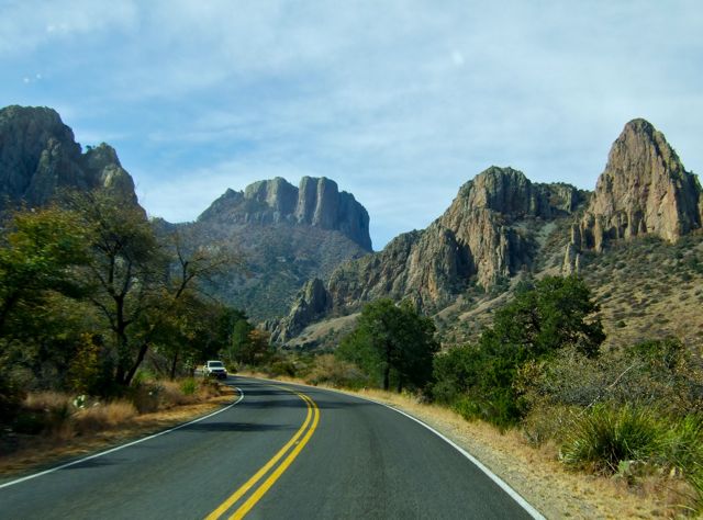
After a three-month long sabbatical, Bullwinkle is back on the road! We left the comfy confines of Kerrville yesterday and headed into the vastness that is west Texas. Our travels on I-10 were quite familiar, as we passed this way last Spring. But, after we turned south on US-67 toward Alpine we were in new territory as we headed toward the mountains of Texas. (Can you see them off in the distance?)

Here in the mountains, such as they are, our home for the week is Lost Alaskan RV Park, which is just a mile or so north of downtown Alpine. At an elevation around 4700 feet, we are definitely “up” here. We love the name of this lovely little park and will be on a mission to discover how it earned its name!

We picked this park to serve as a base for exploring the sights in surrounding Marfa, Marathon and Fort Davis. Alpine is basically the last “outpost” before Big Bend. So, we’ll stock up on supplies here before we head south.

After a day of just relaxing around the park, we spent today getting “oriented”. Our first stop was the Museum of the Big Bend. The museum sits on the campus of Sul Ross State University. The beautiful native stone structure opened in 1937 with a goal to to collect, preserve, exhibit, and interpret the cultural, historic and natural materials of the Big Bend of Texas and northern Mexico.

We were greeted by a very friendly docent who gave us the lowdown on the place and pointed out some of the key features of the museum. Left on our own, we strolled through the displays of early life in the region, including this look back at one of the areas 20 missions that were established in the 1600s.

Commerce came to the Big Bend before currency. Early merchants bartered with customers. In general stores of the era, shopkeepers issued coins that customers could exchange for goods.

Every March and April, the museum hosts a very special exhibit. The Trappings of Texas is the oldest custom cowboy gear and fine western art show in the United States. Each piece displayed in this juried show must fit the theme of cowboy life. Together, these 120 works provide a delightful multi-media mix of the contemporary and traditional West.

The silverwork was beautiful, featuring spurs, knives, jewelry and lots of belt buckles. (We are in Texas, after all!) This hide shaped belt buckle commemorates the silver anniversary of this shiny event.

There were plenty of paintings, many of which featured a touch of whimsy. “Cowboy Photographer” was a watercolor that caught our eye. The old Polaroid made us chuckle.

The intricate braiding on this Texas-style bridle was intriguing.

The leather work on display was most impressive. We’re not horse people, but we were captivated by three saddles. We have never priced saddles, but this gorgeous one was priced at $10,000.

This beautiful saddle was covered with full flower carvings.

The flower carvings went all the way to the stirrups. The price for this field of flowers was $25,000.

The saddle was aptly named “Coming Up Roses”. It featured 250 tooled roses and a sterling silver rose horn cap. Asking price: $30,000. Now those are some mighty fine saddles!


We resisted the temptation to take a saddle home, and instead headed to one of Alpine’s finest restaurants for lunch. Reata is a quaint and very comfortable spot that offers great service and fine Texas cuisine in an old Alpine farmhouse. There were actually other diners there, but we were the last to leave the front dining room.

Now that we’ve been sufficiently oriented, fed and watered, we’re ready to enjoy all the Big Bend region has to offer. With sunny skies and daily highs forecasted in the 80s and 90s during our visit, we’re looking forward to soaking up some serious Texas sunshine.